Fraym is using artificial intelligence and machine learning to help aid organizations in Africa and South Asia identify populations at risk due to Covid-19 using new geospatial visualizations.
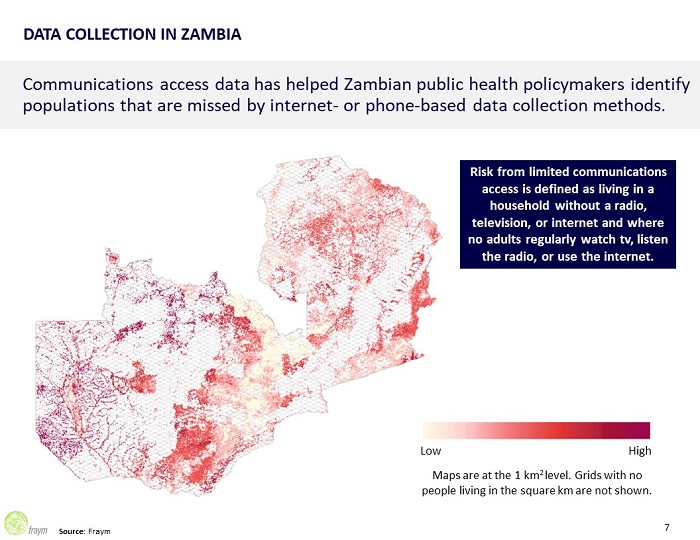
Fraym identifies high-risk populations and how to best communicate with them – making it an invaluable tool for more than 40 organizations and governments fighting the pandemic, including the Nigerian CDC, Kenyan presidential office, Zambian public health policymakers and aid organizations in Pakistan.
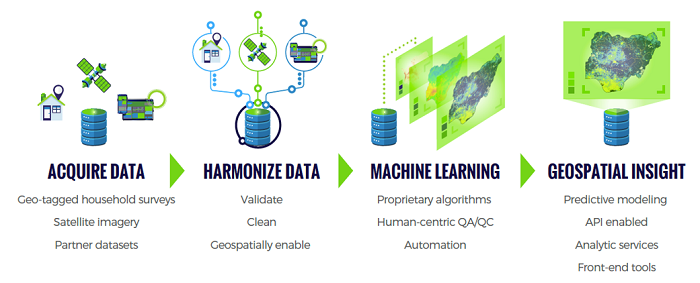
Fraym has mapped communities based on concentrations of common transmission variables and then combined this with data from household surveys and remote sensing data, to then understand how these individuals consume news at a hyper-local level.
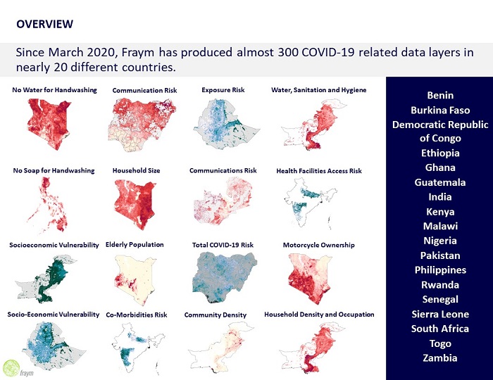
The company is providing this information, which is at a 1-square kilometer level, for free to help fight the spread of Covid19. Since March 2020, Fraym has produced more than 300 COVID-19 related data layers in nearly 20 different countries.
Video of the data tool here and some maps of high-risk communities here. The maps break out hyperlocal data on population density, household size, elderly population and hygiene – all of which predict Covid risk. Taking it into action, the data then helps public health policymakers identify how these populations are accessing information.
This granular information about at-risk populations is invaluable to those fighting the disease on the front lines in Africa, as well as groups interested in how COVID will affect stability in specific geographies.
Sign up for the free insideBIGDATA newsletter.


Speak Your Mind